
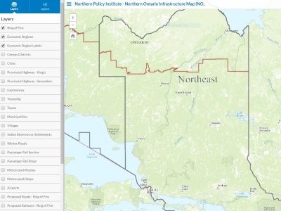
A new map launched by the Northern Policy Institute displays Northern Ontario’s infrastructure assets.
An interactive tool, the map provides a detailed snapshot of the North’s existing groundwork, in order to identify and build on regional strengths, according to Julien Bonin, the map’s creator.
The map has 24 layers of content, ranging from rail and road transportation networks to rest area facilities, population figures, and carriers found at regional airports. With this fully interactive map, users are able to access as much or little information as they wish by adding or removing layers.
It is open for use by anyone.
“This initiative aligns with our mandate to improve measurement in our region and build sustainable community capacity in Northern Ontario,” says Northern Policy Institute president and CEO, Charles Cirtwill in a release.
“NPI encourages everyone to access the tool. More importantly, we invite them to send us updates at mappingthenorth@northernpolicy.ca in order to enhance our collective understanding of the North.
Users can also view multimedia contributions from the public via social media such as Instagram and Twitter.
The map will continue to be updated as new data and information becomes available.


