
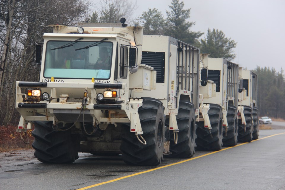
The convoy of 64,000-pound, big white trucks move a few metres down a road in the Capreol area of Sudbury before coming to a stop. Each lets down a vibration pad. There's a low humming noise, and the earth begins to shake.
They're part of the first phase of the Metal Earth project, a $104-million, seven-year research project run by the Mineral Exploration Research Centre, the research arm of Harquail School of Earth Sciences at Laurentian University.
Researchers were conducting a seismic survey, mapping geological features below the earth's surface to a depth of about 40 kilometres in Northern Ontario, northern Québec and Beardmore-Geraldton in late fall.
Metal Earth's goal “is to understand how metals were transported from the mantle to the crust and concentrated during Earth's early evolution four billion to 1.8 billion years ago,” explained Harold Gibson, director of the Metal Earth project.
The seismic survey is being used to “acoustically image the crust like an ultrasound,” Gibson said. It is accomplished by placing geophones every 25 metres along the roadway.
These highly sensitive receivers pick up return vibrations from the transmitting machines that put vibrations into the ground.
“From an exploration or an applied perspective, one of the themes of Metal Earth is to understand why certain areas that are geologically similar in a Precambrian shield are metal endowed, while others are not metal endowed,” he said.
The findings could ultimately be used in mineral exploration to better target areas of interest, Gibson said.
“This is important in the mining sector because they spend so much money trying to find deposits,” he said.
“They don't want to spend it in areas that look good but don't have metal deposits. If we can focus them down to where they have the highest chance, that'll lower the exploration costs, increase discovery rates and help with northern development.”
Metal Earth aims to be a benefit to Northern communities as it winds its way through a stretch of 1,600 kilometres across two provinces, according to promotional material distributed by the researchers.
With fuel, lodging and meal provisions for its 44-member crew, the project will inject upwards of $15,000 each day into local communities.
Gibson said the project is also important in that it's training the next generation of geoscientists, including about 30 post-doctoral students, 80 graduate students and 105 bachelor's students.
This is important because many Ontario geologists are now in their 50s, close to retirement age, Gibson said.
The contractor conducting the seismic survey is SAE Exploration, which typically does exploration work for the oil and gas sector.
Jeff Mackie, general manager of Canadian operations with SAE Exploration, said his company usually maps to a depth of 3,500 metres, but in this project, it's looking at geological formations at 45,000 metres.
“So it's kind of a step out of our comfort zone,” he said.
He said his company is excited to be working with Laurentian on Metal Earth. “We're really excited about the results that will be coming,” he said.


