
One project at Inventus Mining Corporation has become an expedition to solve a mystery billions of years old.
Chief geologist Wesley Whymark said one project is looking more like a mirror image of the Sudbury Basin, while another has been a challenge to accurately gauge gold resources.
He gave an overview of the junior mining company’s latest findings from their work in the Temagami Magnetic Anomaly and Pardo gold project at the monthly meeting of the Sudbury Prospectors and Developers Association, Oct. 16.
Its Sudbury 2.0 Project is in the Temagami Magnetic Anomaly, which starts on Lake Wanapitei, 38 kilometres northeast of Sudbury, and ends on Bear Island in Lake Temagami.
It bears many magnetic similarities to the Sudbury Basin, as well as it is similar in size. But according to geological mapping and theories of the area’s geological history, it shouldn’t be there.
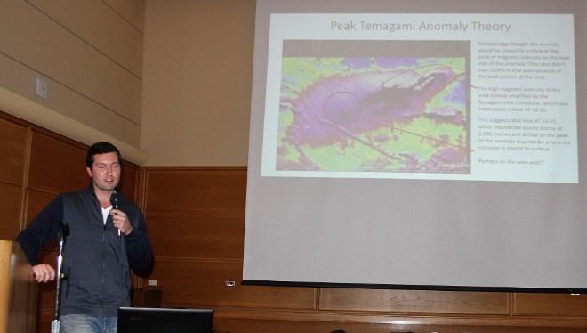
“Falconbridge referred to it as a mirage, which implies there is nothing there, it's an illusion. But we found evidence there is something there,” he said.
He explained the mission is to find the source of the anomaly. And the theory is it originates in Sudbury.
Mapping of the magnetic anomalies and examining the few core samples are indicating there may be some truth to that.
The similarities between the basin and the anomaly could mean there are untapped resources. He pointed out that about $1 trillion in resources has been mined from the Sudbury Basin and is still delivering on more.
Mining potential aside, it has been a mystery since it was first staked in the 1990s by Falconbridge, now Glencore. At the time the company believed it was perfect for exploration due to its size, magnetic intensity and close proximity to the Sudbury Mining Camp. It was theorized the anomaly was caused by an intrusion, but no one could determine where it came from.
Whymark said he believes the anomaly was formed from the Sudbury impact, a meteorite strike 1.8 billion years ago that created the basin. Melted rock seeped into faults caused by the impact and formed the anomaly. At some point, he believes a crater wall may have collapsed as well, pushing some of the melted rock into faults underground.
The question is, is there a link near surface?
A discovery east of Lake Wanapitei adds weight to this theory. A team found a 30-kilometre-long belt of what is known as Sudbury breccia. Up until then, that breccia was only known to be found in the footwall of the Sudbury Impact.
They found evidence of the anomaly coming near surface in two lakes in the belt. The breccia would mean there was a crater collapse and there could be an intrusive of melted rock from the Sudbury Impact underneath.
Inventus is continuing with geological mapping and prospecting to look for more Sudbury-type breccia.
At the Pardo gold project, 65 kilometres northeast of Sudbury, much of the gold is in small pockets, making drilling for accurate samples challenging.
Using a diamond drill hole only shows a tiny amount of material in the area, Whymark said. If they don't see a gold cluster in that core sample, it's easy to assume there is no gold contained in that area.
They are running a project of closely spaced drills to determine how thick the mineralization is laterally
“Because the gold is spread out in the crevices between boulders, it’s hard to find the gold clusters with drill holes. Our best way has been to make a lot of drill holes in a small area,” Whymark said.
To prove how challenging it's been, he described a bulk sample of an area that had been drilled. After processing, the estimated gold resources contained in that area increased by 300 per cent.
Because of the difficult conditions, Inventus is estimating gold grades from best case scenario to worst case. This summer, they updated their National Instrument 43-101 technical report and included an exploration target range with three categories: most pessimistic, moderate case, and optimistic.
Their most pessimistic estimate was 400,000 tonnage, a metal content 60,000 ounces with 4.20 grams per tonne gold, to an optimistic 12.5 million tonnage, a metal content of 1.4 million ounces with 3.5 grams per tonne gold.
Future plans for the project include continuing with drill hole examination for the material to expand the footprint, following up in areas where they can, taking a bulk sample and getting a grade for the area.


