
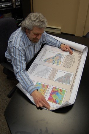
The sprawling map of survey data recently released for the Burntbush area north of Cochrane may mean little to the layperson, but something about it catches the eye of Discover Abitibi project manager Bob Calhoun.
He jabs his finger onto a brightly-colored blotch, mutters under his breath, and pauses for a second.
"That...that could be something," he says to himself.
"I'll have to look into that later."
It's this very same level of interest in the northeast that the Discover Abitibi Initiative, a function of the Timmins Economic Development Corporation, has hoped to spark among exploration companies.
This is true of its Burntbush surveying project in particular, which was made possible through funding and partnerships with a broad spectrum of federal and provincial government agencies, as well as the private sector.
Conducted throughout 2008, the aeromagnetic surveys over the Burntbush area produced more than 35,000 line kilometres of high-resolution magnetometer data.
The last time this kind of survey work was performed on the area was in the late 1980s, when survey technology was less precise, and the software which processes the results was less advanced.
Rather than flying the magnetometers at a quarter-mile above the ground with 250-metre line spacing as was done in the past, current efforts were done 80 metres off the ground with 100-metre line spacing.
The collected data also includes GPS coordinates, providing a much higher level of confidence, "so that if we say something is right there, it's right there," says Calhoun.
The data provides such an accurate picture of the local geology that companies could use the data to begin drilling, he adds.
Although it's hoped that the data will have a strong uptake among private sector firms once investors begin to pour more money into exploration company coffers, results have already proven to be of some use.
A handful of companies have snapped up the data to do some preliminary work and to feed into existing projects. This means that although the cash flow has tightened, there still remains an interest to keep working and digging through the hills of the North, says Calhoun.
The information has also been particularly useful to the Ontario Geological Survey (OGS), according to John Ayer, a geoscientist with the Precambrian Geoscience Section of the OGS.
The OGS is already making use of the information to improve its continuing efforts to produce a 1:100,000 scale geological compilation of the Burntbush area.
Much of the bedrock geology in the region is covered in up to 100 metres of overburden, such as glacial till and clay, with less than one per cent of exposed bedrock. As such , it's been particularly interesting to discover that greenstone belt rocks are located in areas which were previously thought to contain granitic rocks, says Ayer.
"It's the same package of rocks as we have through the whole of the Abitibi, which is probably given us maybe $200 billion of mineral wealth over the last 80 years or so. So there's a lot of potential, but it's a very difficult area to explore in because you don't have much rock to look at."
Work is currently underway on two more surveys, with the results expected to be released in the coming weeks.
This includes a closer examination of the Detour Lake area. In this region, junior exploration firm Detour Gold is trying to prove up a deposit and has contributed to the survey project.
The second survey involves the Shining Tree area, southwest of Gowganda.
Once these projects are wrapped up, a series of ground surveys will be undertaken.
Calhoun touts the level of collaboration needed to get the project off the ground, having worked closely with the likes of Natural Resources Canada's Geological Survey of Canada as well as the OGS. The two latter firms are also co-publishing the data, and have both made the information available on their websites.
"If there's one thing this initiative is really good at, it's bringing people together."
www.discoverabitibi.com
gdr.nrcan.gc.ca/aeromag
www.mndm.gov.on.ca


