
The Ontario Geological Survey (OGS) completed the first year of a three-year geological mapping project along the Highway 11 corridor last summer, a project that will guide land use planning for the corridor between Cochrane and Kapuskasing.
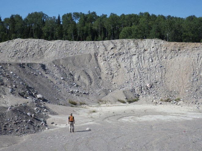
Quaternary or surficial mapping is the study and cataloguing of the loose material atop the bedrock, left behind by the movement of receding glaciers.
Specifically, Quaternary refers to the period of time lasting the last several hundred thousand years, noted Richard Dyer, manager of geoscience mapping in the Earth Resources and Geoscience Mapping Section of the OGS.
“There are multiple uses for the information, and that’s the beauty of it,” Dyer said. “It satisfies a lot of needs.”
For the first year of the Highway 11 corridor project, mapping took place in the National Topographic System (NTS) areas of Kapuskasing, Smooth Rock Falls, Bradburn Lake, Cochrane, Abitibi, and Iroquois Falls.
Similar projects are being conducted across the province, but with limited resources. Dyer said the OGS tries to focus on areas that have a great interest or are of a high priority.
In the case of the Highway 11 corridor, the mapping is taking place for two reasons.
“We don’t have a lot of detailed information along the corridor at this point in time, and also because of OMAFRA’s (Ontario Ministry of Agriculture, Food and Rural Affairs) interest, so they were encouraging us to do some mapping up there,” Dyer said.
OMAFRA is currently in the process of updating its agricultural soils maps, and so the information provided by the OGS helps the ministry identify which lands to set aside for agriculture, in addition to other land-use planning purposes.
“I think there are a lot of abandoned areas that aren’t being used anymore, but perhaps there’s potential and a need, and/or a desire, to start doing some more agriculture up there,” Dyer said. “So if you have the kind of maps we produce, that will help focus where might be good areas to do agriculture.”
The information is useful for other land-use planning as well, including municipalities trying to decide where to locate a landfill.
If an area is comprised mostly of sand, for example, it would be unsuited to a landfill, because sand is permeable and would allow for leakage, Dyer said.
But a clay-rich area would be favourable, because clay acts as a barrier, preventing water from seeping through. Roads crews are also always looking for sources of aggregate, like sand and gravel, for the development of roads.
Because it’s expensive to haul aggregate, it’s preferable to find a source closer to the development site, Dyer noted.
A final purpose behind surficial mapping is to help identify areas of exploration for prospectors and geologists looking for the next big discovery.
By studying till — the material picked up by a moving glacier and deposited along its path — the OGS can pick out traces of minerals and track them back to potentially valuable mineral deposits.
“We look at bedrock, and if we see striations and long linear lines, that tells us that the glacier likely travelled in that direction,” Dyer said. “So then we can just basically vector, go back that direction, to prospect for the source.”
The data collected last summer is still being analyzed, but Dyer expects a full report on the first year of activity shortly. In its second year, the project will continue to the west within the Kapuskasing and Bradburn Lake areas.


