
A trip to the world’s largest mining show may soon bear fruit for a Thunder Bay geomatics firm, once heavily invested in the forestry industry.
No question, forest resource planning and data-gathering is still the bedrock business for Sumac Geomatics, but the 21-employee firm wants to pursue more clients in mining, agriculture and land development.
CEO Todd Domney said the company name change from Sumac Forest Information Services to Sumac Geomatics is a reflection of how they now view themselves and the widening client base they are targeting.
This past March, Sumac made its first appearance as an exhibitor at the trade show of the Prospectors and Developers Association of Canada’s annual conference.
“A big part of it for us was trying to understand what the mining industry needs or wants. Truthfully, the timing couldn’t have been worse for us,” Downey chuckles, about the current industry down-cycle, “but we were extremely pleased with how the show went.”
They came off the floor with “four or five” requests for quotes, but what was more encouraging was the number of mining service companies looking to potentially partner with Sumac.
“In chatting with the mining companies, there seems to be a lot more interest on the environmental side,” said Domney.
Sumac has found work as a subcontractor to mine engineering firms in flying mine site tailing ponds with their unmanned aerial vehicles (UAVs) to provide volume metrics, often used in permit applications to expand these facilities.
Providing precise images and interpreting what they see, Domney believes, is the clear competitive advantage they have built up over two decades of accumulated experience in photo interpretation and GIS technology.
“What we found with our clients is that (experience) matters a lot. We’ve been working in the engineering space and ensuring that we’re doing things to the highest possible remote sensing standards,” said Domney.
“If it’s a tailings management facility and you get it (the volume metrics) wrong, there’s hundreds of millions of dollars at stake. You’ve definitely got to make sure you have your technology down and know exactly what it’s doing and giving back to the clients.”
Domney, who began in forestry as a timber cruiser, established Sumac with partners Dave Carr and Tom Shields in 1996.
A major swing for the company occurred in late 2011 when Sumac was subcontracted for a company that entered receivership. Sumac acquired their Thunder Bay assets and salvaged some of the projects.
“That jump-started things for us,” said Downey. “Until that point, we were very much a forestry and field service company.”
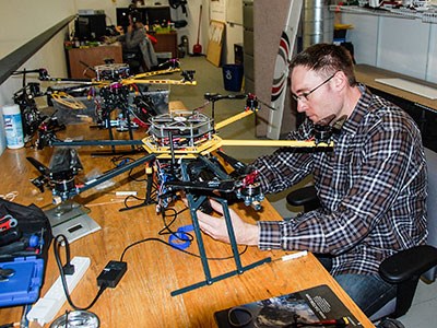
The firm quickly grew from its three principals and four employees to 15 staff. With the advent of unmanned aerial vehicles (UAVs), today it stands at the current 21, most of them working in photo interpretation and GIS applications in their Dawson Road shop.
Some of their clients include Domtar, LTL Contracting and engineering firms like AMEC and Hatch Mott MacDonald.
After buying a Precision Hawk UAV in late 2013, Sumac now has four drones, including two hexacopters from Kildir Technologies of Quebec.
“They’re a very simple and robust design,” said Domney of Kildir’s drones. “These ones are purpose-built for mapping applications.”
Besides camera attachments, the drones can be outfitted with multispectral, thermal and LiDAR technology.
To expand their understanding of mining, Sumac is collaborating with Queen’s University geoscience researchers on a proof of concept related to 3-D aerial magnetometry, a major mineral exploration tool.
“They’ve approached us because we have experience with flying systems,” said Domney. “They do the aerial mag that creates the targets. Now let’s look at these targets in very high resolution, or high probability, and see if that tells us something more.”
It’s not going to replace manned aircraft, he said, but “let’s use the technology available in its most optimal configuration which is small, low and slow.”
Forestry still remains in the mix as Resolute Forest Products in Thunder Bay is a main client.
Using UAVs, Sumac provides regular volume metrics on their mountainous wood chip piles.
Another forestry company is working with them on a solution to aerially assess saw logs in the mill yard and segregate them by species, log length and final product type.
While the list of what a drone can do is a mile long, Domney said there are limitations.
In mapping applications, UAVs are most apt to provide high resolution imagery for a small defined space as opposed to a large contiguous claim block for an exploration company.
“If you’ve got a point of concern or target, that’s where UAVs will excel; if it’s something you want to look at in high detail and you want to look at it repeatedly through time.”
Applying their knowledge to community land-use planning in the Far North is limited due to federal line-of-sight regulations.
“We would like to get long range aircraft but until we see the rules change with Transport Canada there’s not much point in chasing that at this point.”


