
Matawa First Nations, a tribal council representing nine First Nations in northwestern Ontario, is taking a proactive approach with land use management to safeguard its cultural and historical values.
The council has adopted geographic information system (GIS) technology to collect and store traditional values data, which is then applied to discussions with mining companies regarding potential claims in its territory.
In the works since January 2011, the project was undertaken to build capacity within Matawa’s communities, explained Kyle MacLaurin, Matawa’s GIS/data specialist. In the past, the council had to hire a consultant for data collection purposes. By investing in the technology, the community is taking control of its own data management.
“We’ve decided that what we want is to integrate the system into the tribal council and then train our communities on how to do our own mapping, so that we don’t have to constantly start from scratch every time a new project comes through,” MacLaurin said.
When any of the communities are approached about resource development in their territories, they can use the data to determine whether there may be an infringement on their cultural values—traditional hunting areas, archaeological sites, former Aboriginal settlements or burial grounds—and take that information into discussions with mining companies.
MacLaurin trains people in mapping and data collection skills, after which the communities take responsibility for gathering their own information. In addition to capacity building, training community members means enhanced employment opportunities.
Though cultural values collection is the current focus, MacLaurin believes that eventually the communities will be able to get into their own natural resource management.
Alex Miller, founder and president of Esri Canada, the manufacturer of the ArcGIS software, said GIS is being widely used across the country by First Nations, which view it as a cost-effective way to map out their land use.

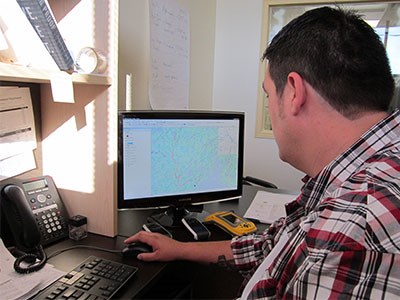
Members of the Matawa First Nations council conduct GIS mapping, data from which will eventually go into a database that can be updated with historical and current information.
“The federal government for many years has really treated the First Nations pretty patronizingly with collecting their data on where their properties are, where the lots are on the reserves,” he said. “A lot of First Nations are really developing the skills to take that over and start managing their own reserves and their own nations.”
Adopting the technology has been a switch in mindset for many communities, which traditionally passed knowledge between generations orally before turning to written knowledge and then digitally mapped data stored in an information system, Miller said.
Mining, which has typically been slower in adopting the technology for mine mapping, is now one of Esri’s fastest growing markets, Miller said. Miners are combining the use of GIS technology with traditional geological maps and information gleaned from airborne geophysical surveys and geochemical surveys.
It can be a worthwhile endeavour for mining companies since consultation and negotiation with First Nations, on whose land they propose development, is compulsory and an increasingly important component of mineral development.
“They have to do a lot of land-use planning with the First Nations,” Miller said. “They have to be able to do community-based planning with the First Nations to make sure they’re not upsetting their traditional hunting grounds or trapping lines, or destroying things that are valuable to the First Nations and to society in general.”
Having GIS information on hand gives both First Nations and mining companies a good starting point to understanding their joint challenges in developing a project, Miller said. Mining companies want an economically viable mine, while First Nations want revenue from their resources, while being mindful of the environment and their traditional uses of the land. Having GIS data gives them a frame of reference to start discussions.
MacLaurin believes it will be between one and three years before the communities start to see positive effects of the capacity building resulting from the adopting GIS. But as communities increase their proficiency with the technology, they’ll be able to do more with it.
“We can do more natural resources with it, not just mapping,” he said. “So they can come in afterwards with it and they know they can help with a balance between economic development and protection of the land and the values.”


